
4DS Drone Services - professional drone Services
Providing expert drone services to estate agents and construction & Engineering companies
across Lincolnshire, the East Midlands, the East of England, and throughout the UK Wide.

Drone Contracted Services
We offer a multitude of drone services from aerial photographs and video to orthomosaic images of large areas.
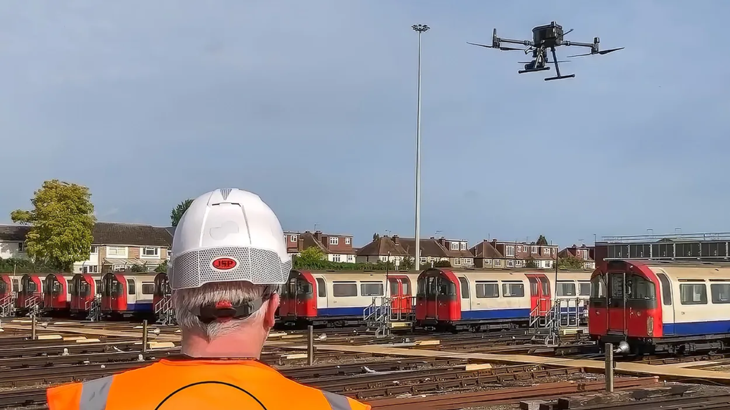
Asset inspections, Aerial and confined space inspections can be performed without the risk of working at height or within dangerous confined areas.
Provided this as a service to Surveyors / Engineers and ther industry suppliers.


Drone Photography
Unlock the potential of property marketing with 4DS Drone Services. Our drone services offer unparalleled aerial photography and aerial videography that brilliantly capture the essence of real estate properties.
By providing unique perspectives, our footage accentuates landscapes and essential property details, enhancing your listings with eye-catching visuals.

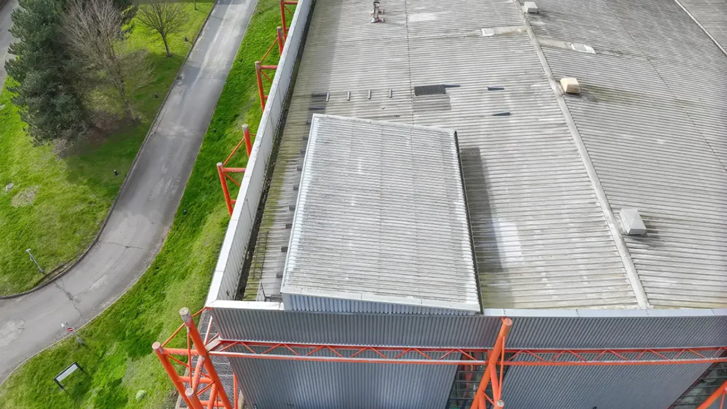

Drone Roof Inspection
We can give you a series of high-resolution images and high definition 4K video of most hard to reach structures.
You can even monitor the footage being gathered on our remote ground station screen in real-time to make sure you’re getting exactly the images you need.
In addition there’s no longer the need for anyone to leave the ground so the project is obviously much safer.


Drone Asset Inspection
We offrer 2D & 3D Mapping
Measuring and creating digital elevation models, identying landmarks, and inspecting assets are made easy by utilising drone based photogrammetry techniques.
Utilising a range of Software solutions to produce accurate 2D and 3D models.

Drone Inspection - Confined Space
Using cutting-edge drone technology, 4DS Drone Services offer the safest and most cost-effective method of accessing and inspecting confined spaces, without the need for costly and specialist planning and mobilisation. Our UAV services provide a seamless approach to challenging environments while prioritising safety and efficiency.The Power of Drone Inspections
Confined Space Inspection. Read More...
360 Virtual Tours
At 4DS Drone Services, we redefine the way you explore spaces with our state-of-the-art 360 virtual tours. Offering an immersive, detailed experience that enhances visualization, our tours are indispensable for real estate and commercial sectors seeking to showcase their properties and projects effectively.
Drones are a powerful tool for todays industry
Contact 4DS Drone Services Today -
Contact@4dsdrone.com

Operating within and around No-Fly Zones (NFZ) can be challenging. Locations like Lincoln, situated within EGR313 Scampton and EGD324A Waddington LOW NFZ Airspace, pose restrictions. Despite these, our expertise enables us to secure all necessary permissions, ensuring uninterrupted service delivery whilst adhering to regulations.
Your Strategic Partner
Partner with 4DS Drone Services for integrated drone solutions that drive value for your enterprise. Contact us at david@4dsdrone.com or call +447391233647 to learn more about how our drone services can elevate your business operations.